
SERVICES


From raw coordinates to real-time intelligence
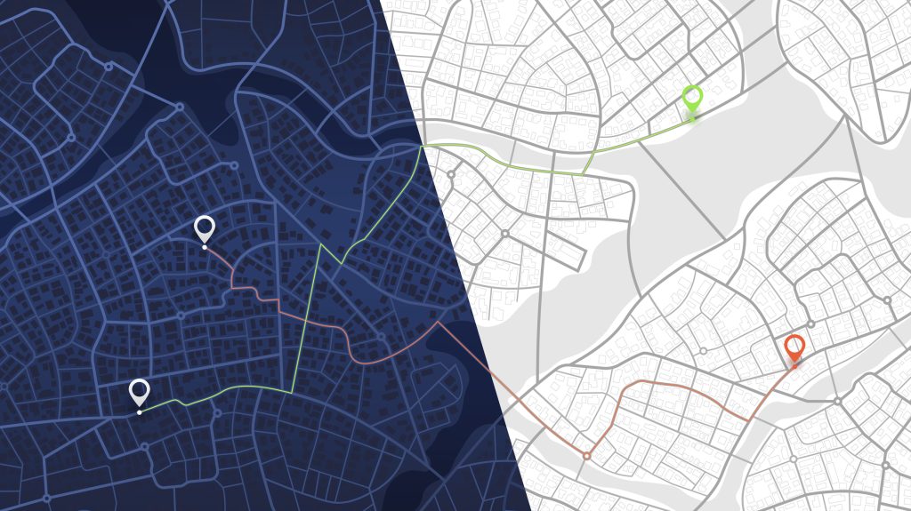
Every organisation, whether managing homes, hospitals, or highways, depends on location. Where things happen shapes why they happen and what we should do next.
Yet, many teams still treat geospatial data as a specialist discipline locked inside GIS (Geographic Information Systems) tools, accessible to only a few experts. This creates silos and delays, when in reality, location is everyone’s business.
It’s time to bring geospatial intelligence out of the GIS corner and into the Databricks Lakehouse, governed, scalable, and available to every data-driven team.
With Spatial SQL, Lakeflow, and Unity Catalog, organisations can now turn coordinates into context and context into action, moving beyond static maps to living, real-time insights that evolve with the world.
Why Geospatial Matters Now
Almost every modern decision has a location attached, from repair requests and clinic visits to delivery routes and marketing clicks. Hidden within these coordinates are powerful patterns about how the world operates.
Too often, this data sits disconnected across systems, refreshed long after decisions are made. Geospatial analytics bridges the gap connecting data about things with data about where those things happen.
Databricks makes that bridge accessible to everyone – not just GIS specialists, but analysts, engineers, and decision-makers across the business.
To understand how this changes real-world operations, let’s meet a few familiar practitioners who all face the same challenge: disconnected location data.
Sophie, Maintenance Operations Lead (Housing Association)
It’s 3 PM on a Thursday, and Sophie needs to dispatch repair teams efficiently, but her data resides everywhere:
- Repairs in a housing system
- Contractor details in procurement
- Energy ratings in spreadsheets
- Location data in separate GIS files
The result? Hours wasted merging maps before the first van leaves.
With Databricks Spatial SQL and Lakehouse Federation, Sophie can now:
- Join property, repair, and contractor data into one Delta table
- Cluster nearby jobs using spatial joins
- Overlay flood and weather data to prioritise risk
- Visualise routes, costs, and technician positions in real time
Now, instead of reactive scheduling, her team runs on geospatially intelligent operations – saving time, fuel, and budget.
Daniel, Supply Chain Manager (Logistics Partner)
Daniel oversees hundreds of daily deliveries, yet inefficiencies abound. Vehicles double back across towns, stock levels are unclear, and every system tells a different story.
By unifying logistics, inventory, and spatial data in Databricks, Daniel gains real-time visibility:
- Vehicle telematics streamed live into Delta tables
- Supplier systems connected through Lakeflow Federation
- Spatial SQL calculates the nearest depot for each job
- H3 indexing identifies regional delivery bottlenecks
His dashboards now show live routes, costs, and stock by region, enabling dynamic route optimisation and predictive inventory planning.
Amira, Healthcare Operations Lead (Regional Health Trust)
Amira must decide where to deploy staff as a surge in respiratory cases spreads. But patient admissions, ambulance feeds, and hospital data all live in separate systems.
Using Databricks Spatial SQL and Unity Catalog, Amira can:
- Combine patient flow, dispatch, and health indicators into one governed Lakehouse
- Identify clusters of cases via spatial joins
- Map transport times to locate nearest clinics with capacity
- Forecast surges using H3 density indexing
For the first time, her team moves from reactive management to proactive care coordination shifting resources before pressure reaches critical levels.
Zenaida, Marketing & Insights Director (Retail & Media Group)
Zenaida’s latest campaign looked great on paper, but sales vary wildly by region. She can track clicks, but not footfall, proximity, or conversion.
With Databricks, she can finally connect marketing reach, store performance, and audience movement:
- Use H3 grids to visualise engagement by region and time
- Combine ad, sales, and logistics data into one governed Delta model
- Run spatial joins to link exposure with local purchasing patterns
- Ask Genie: “Show me areas where campaign engagement is high but stock is low.”
The result? Live heatmaps of opportunity and real-time marketing optimisation.
From Stories to Systems
Across housing, healthcare, logistics, and retail, the challenges sound the same:
Data tells teams what is happening, but rarely where or why. Systems are fragmented, reports are delayed, and decisions are made in the dark.
Databricks changes that.
By bringing spatial awareness directly into the Lakehouse, Databricks makes geospatial analytics accessible to every user, not just GIS experts, creating a shared foundation for location-driven decision making.
Empowering Every Team to Think Spatially
Databricks unifies three essential layers; data, governance, and insight, enabling geospatial intelligence at scale.
- Spatial SQL: Handle spatial data at scale with native GEOMETRY and GEOGRAPHY types, no external GIS required.
- H3 Indexing: Perform high-performance proximity analyses and aggregations with hexagonal precision.
- Unity Catalog & UC Metric Views: Govern once and reuse everywhere with consistent, auditable spatial logic.
- AI/BI Genie & Dashboards: Deliver instant insights through natural language queries and interactive visualisation.
This combination moves organisations from static maps to living insights that evolve in real time.
The Complete Geospatial Journey on Databricks
1. Data Ingestion and Federation: Bringing the World into the Lakehouse
Geospatial data rarely lives in one place. Housing teams need property coordinates; retailers need catchment zones; healthcare relies on postcodes; logistics on IoT telemetry.
Lakeflow automates ingestion from APIs, CSVs, cloud storage, and enterprise systems.
Lakehouse Federation allows querying spatial data where it resides, in PostGIS, Snowflake, or S3, without duplication or delay.
This unified access layer removes the biggest barrier in spatial analytics: reconciling multiple systems before analysis begins.
2. Core Platform: Where Spatial Becomes Scalable
Once ingested, spatial data becomes a first-class citizen of the Lakehouse.
- Store points, lines, and polygons directly in Delta tables.
- Access 80+ Spatial SQL functions, from ST_Intersects to ST_Buffer.
- Use H3 indexing for global hexagonal aggregation and coverage analysis.
- Integrate with Databricks Mosaic for advanced spatial transformations.
All of this operates within Unity Catalog’s governed framework, ensuring consistent logic and fine-grained access control across teams.
3. Consumption: Turning Coordinates into Decisions
Once unified and governed, spatial data powers insight across every role:
- AI/BI Dashboards for interactive regional mapping and real-time visualisation.
- Genie for natural language queries:
- “Which hospitals are within 15 minutes of dispatch centres?”
- “Where are repair costs per mile highest this week?”
- Excel live connections for business users in familiar environments.
- Felt and partner tools for advanced spatial visualisation.
- Agent Bricks for automated monitoring and proactive optimisation.
From field teams to executives, everyone operates on the same trusted, spatially aware data.
Real-World Impact
With the Databricks Lakehouse for Geospatial Intelligence:
- Housing associations plan repairs efficiently by clustering nearby jobs.
- Healthcare providers route patients dynamically and predict service demand.
- Retailers align marketing spend and stock geographically in real time.
- Logistics operators optimise routes and reduce emissions through spatial insights.
- Energy and environment agencies monitor and model change across vast landscapes.
This is the future of location intelligence, one governed, open, and scalable platform uniting the power of data, AI, and geography.
Final thoughts
Geospatial intelligence isn’t just about maps, it’s about context. It turns data points into patterns and patterns into decisions.
With Databricks, organisations finally have a way to bring every coordinate, every dataset, and every user into one connected view, transforming where things happen into why they matter.
